
Natural Landmarks of the Motherland: River Nile (Egypt)
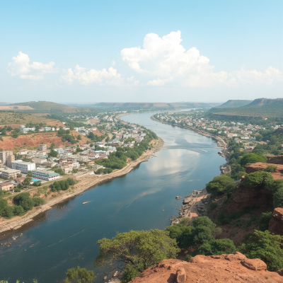
The River Nile is the heart of North Africa (Imagined by AI)
The River Nile: Lifeblood of Africa’s Civilizations
The River Nile is more than just a river. It’s a force of nature. A giver of life. A cradle of civilization. Stretching over 6,650 kilometers (4,130 miles), the Nile flows northward through northeastern Africa, touching ten countries: Burundi, Rwanda, the Democratic Republic of the Congo, Tanzania, Kenya, Ethiopia, Uganda, South Sudan, Sudan, and Egypt.
This mighty river has shaped Africa’s geography, economies, and history for thousands of years. It’s often called the longest river in the world, and recent discoveries may have extended its reach even further.
Two Great Rivers Become One
The Nile begins as two major tributaries: the White Nile and the Blue Nile.
The White Nile rises in the Great Lakes region of central Africa. Its furthest source is still debated, but many researchers trace it to Burundi or Rwanda. From there, it travels north through Tanzania, into Lake Victoria, then flows out through Uganda and into South Sudan.
The Blue Nile, shorter but more powerful, begins at Lake Tana in the Ethiopian highlands. It brings most of the river’s fertile silt and fresh water. From Ethiopia, the Blue Nile cuts across the highlands before joining the White Nile in Khartoum, the capital of Sudan.
This confluence marks the birth of the unified Nile, which continues northward through the deserts of Sudan and Egypt.
The Nile Through Egypt and Beyond
In its northern stretch, the Nile is a lifeline running through arid deserts. It nourishes a green corridor that supports millions. Ancient Egyptian cities, temples, and monuments still line its banks.
From the southern city of Aswan to the sprawling Nile Delta, this river feeds nearly all of Egypt’s agriculture. Without it, much of Egypt would be a barren desert.
The Nile finally spills into the Mediterranean Sea, splitting into multiple channels and creating one of the world’s largest deltas.
A Complex Basin That Powers a Continent
The Nile’s drainage basin covers more than 3.25 million square kilometers—about 10% of Africa’s total landmass. It’s one of the most complex river systems in the world. The flow at any point depends on rainfall, evaporation, human usage, and underground water tables.
This basin not only supports farming and fishing but also fuels hydroelectric projects like the Aswan High Dam in Egypt and the Grand Ethiopian Renaissance Dam upstream. Consequently, managing the Nile’s waters has become a geopolitical challenge, especially as countries vie for control over this precious resource.
Where Does the Nile Truly Begin?
Traditionally, Lake Victoria has been accepted as the Nile’s source. But Lake Victoria has its own feeder rivers. The longest of these is the Kagera River, which enters the lake near Bukoba, in Tanzania.
The Kagera itself has two main tributaries:
-
The Ruvyironza River, which originates in Bururi Province, Burundi
-
The Nyabarongo River, which flows from Nyungwe Forest in Rwanda
These rivers merge near Rusumo Falls on the Rwanda-Tanzania border. Because of this complexity, pinpointing the “true source” of the Nile has long been debated.
A New Discovery Changes the Game
In recent years, a team of explorers traced the Rukarara River, a remote tributary of the Nyabarongo in Rwanda, deeper into the Nyungwe Forest. Battling thick jungle and steep terrain, they followed an active surface flow upstream.
Their findings suggest a new source of the Nile, farther south than previously believed. With this, the total length of the Nile extends to 6,758 kilometers (4,199 miles)—still the longest river on Earth by most estimates.
This discovery also elevates Rwanda’s Nyungwe Forest to historic importance. It’s now considered the birthplace of a river that carved the path of empires.
More Than a River: A Living Legacy
From the marshes of South Sudan to the grand temples of Luxor, the Nile is woven into the very fabric of Africa’s heritage.
For millennia, the river has nourished fields, supported cities, and inspired legends. The ancient Egyptians called it Iteru or H’pī. In Coptic Egyptian, it’s P(h)iaro, and in Amharic, ʿAbbai.
Even today, its waters connect diverse cultures, languages, and economies. It flows through bustling cities and remote villages alike, uniting millions of people along its winding course.
Fast Facts About the Nile
-
Length: 6,650 km (4,130 miles), possibly 6,758 km (4,199 miles) with new discoveries
-
Countries: 10 – Burundi, Rwanda, DRC, Tanzania, Kenya, Uganda, South Sudan, Sudan, Ethiopia, Egypt
-
Major Tributaries: White Nile, Blue Nile
-
Confluence Point: Khartoum, Sudan
-
End Point: Mediterranean Sea via the Nile Delta
-
Drainage Basin: Over 3.25 million sq km (10% of Africa)
-
Cultural Sites: Ancient Egyptian temples, cities, pyramids
-
New Source Region: Nyungwe Forest, Rwanda
The Future of the Nile
With climate change, growing populations, and competing national interests, the Nile faces new pressures. Countries along its basin are investing in dams, irrigation, and infrastructure.
Yet, cooperation is key. The river must be shared fairly and sustainably to ensure it continues to support life for generations.
As we deepen our understanding of the Nile’s origins and its course, we’re reminded that this river is not just a natural wonder—it’s a symbol of resilience, unity, and Africa’s enduring greatness.
Conclusion
The Nile is more than a line on the map. It is Africa’s eternal thread—binding mountains, forests, deserts, and civilizations. From hidden springs in Rwandan highlands to the pyramids of Egypt, the Nile tells the story of a continent, written in water.
And with every new discovery, that story grows richer.
Read more about Natural Landmarks of Africa