Natural Landmarks of Africa

The Agbokim Waterfalls (Nigeria)
The Agbokim Waterfalls is located in Cross River State, about 17 kilometres from Ikom and 315 kilometres from Calabar, in the Etung Local Government, very close to the Nigerian-Cameroonian border.
The waterfall comprises seven streams, each cascading over and down cliffs, giving the fall the appearance of having seven faces. The waterfall descends into a rich, tropical rainforest in a terraced fashion. The surrounding forest is itself a wonder, with its lush and bright green vegetation. Surrounding the fall are steep hills and valleys; nature’s beauty and wonder at its finest.
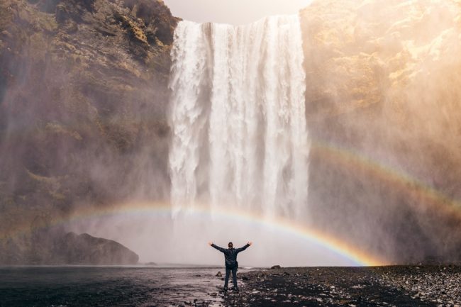
Another unique feature of the Agbokim Waterfalls is that, unlike other waterfalls that dry up or diminish in velocity with the seasons, this wonder of nature remains full all year round. The scenic waterfall appears as a falling sheet of water and at just the right moment, the Traveler can watch the mist drift off the crashing waters, creating bright rainbow colours. From the hillsides, the falls create a picture of running pillars of water crystals crashing at the base, with loud roars and lots of white foam.
The freshness and captivating serenity make the Agbokim Waterfalls an ideal vacation destination as it is closely located to the Obudu Cattle Ranch, providing the great environment for picnics, relaxation, and simply kicking back and rejuvenating in the tranquil atmosphere. (Contributed by: Opeyemi Jide-Ojo)
We also recommend: Kingdoms and Monuments of Afre-Kh, African Adam: Gnosis or Heresy?

Avenue of Baobabs (Madagascar)
On the west coast of Madagascar, there is an ancient magical forest of Baobab trees. Lovingly called ‘Renala’ (aka Adansonia za) by the locals, some of the trees age over a thousand years old. The Baobabs of Madagascar are unique to this region and are revered as sacred by the people. Growing up to 30 meters in height, about 20 odd trees line an old road, creating an avenue. Another score of trees are scattered all around the area surrounded by rice paddies. Almost 10 kilometres away, a pair of the trees are twisted together. The crux of a love fable, the intertwined trees tell the tale of an ill-fated affair between two young lovers who were betrothed to others. Determined to find a way to be together, the folklore recounts that the young lovers visited the local deity and asked for help to fulfil their dream of being together forever, which was granted as they both changed form into trees that were united forever in love just as they had wished.
Attracting tourists from all over the world, the Avenue of Baobabs has in recent years been granted protected status as the Country’s first natural monument and an eco-tourism project aimed at conserving the area and local community has been developed.

The Serengeti Natural Reserve (Kenya and Tanzania)
The Serengeti is a geographical region in Africa that is located in north Tanzania and extends to south-western Kenya between latitudes 1 and 3 S and longitudes 34 and 36 E. It spans some 30,000 km2 (12,000 sq mi). The Kenyan part of the Serengeti is known as Maasai (Masai) Mara.
The Serengeti hosts the largest terrestrial mammal migration in the world, which is one of the ten natural travel wonders of the world. The Serengeti is also renowned for its large lion population and is one of the best places to observe prides in their natural environment. The region contains the Serengeti National Park in Tanzania and several game reserves. Serengeti is derived from the Maasai language, Maa; specifically, “Serengit” meaning “Endless Plains”.
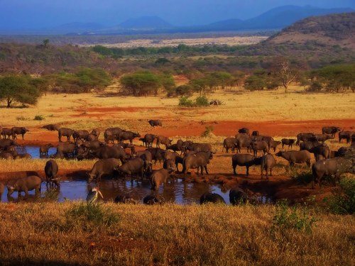
Approximately 70 larger mammals and some 500 avifauna species are found there. This high diversity in terms of species is a function of diverse habitats ranging from riverine forests, swamps, kopjes, grasslands and woodlands. Blue wildebeests, gazelles, zebras and buffalos are some of the commonly found large mammals in the region.
History
Much of the Serengeti was known to outsiders as Maasailand. The Maasai are known as fierce warriors and live alongside most wild animals with an aversion to eating game and birds, subsisting exclusively on their cattle. Historically, their strength and reputation kept the newly arrived Europeans from exploiting the animals and resources of most of their land. A rinderpest epidemic and drought during the 1890s greatly reduced the numbers of both Maasai and animal populations. The Tanzanian government later in the 20th century re-settled the Maasai around the Ngorongoro Crater. Poaching and the absence of fires, which had been the result of human activity, set the stage for the development of dense woodlands and thickets over the next 30–50 years. Tsetse fly populations now prevented any significant human settlement in the area.
By the mid-1970s wildebeest and the Cape buffalo populations had recovered, and were increasingly cropping the grass, reducing the amount of fuel available for fires. The reduced intensity of fires has allowed Acacia trees (the seedlings of which are the favoured food of the elephants) to once again become established. By the mid-1970s wildebeest and the Cape buffalo populations had recovered, and were increasingly cropping the grass, reducing the amount of fuel available for fires. The reduced intensity of fires has allowed Acacia to once again become established.
Two World Heritage Sites and two Biosphere Reserves have been established within the 30,000 km² region. Its unique ecosystem has inspired writers from Ernest Hemingway to Peter Matthiessen, filmakers like Hugo von Lawick and Alan Root as well as numerous photographers and scientists.
The Serengeti ecosystem is one of the oldest on earth. The essential features of climate, vegetation and fauna have barely changed in the past million years. Early man himself made an appearance in Olduvai Gorge about two million years ago. Some patterns of life, death, adaptation and migration are as old as the hills themselves.
Great migration
It is the migration for which Serengeti is perhaps most famous. Over a million wildebeest flow south from the northern hills to the southern plains for the short rains every October and November, and then swirl west and north after the long rains in April, May and June. So strong is the ancient instinct to move that no drought, gorge or crocodile-infested river can hold them back.
Each year around the same time the circular great wildebeest migration begins in the Ngorongoro area of the southern Serengeti of Tanzania. A natural phenomenon determined by the availability of grazing. It is January to March when the calving season begins. A time when there is plenty of rain-ripened grass available for the 750,000 zebra that precede 1.2 million wildebeest and the following hundreds of thousands of other plains game.
During February the wildebeest spend their time on the short grass plains of the southeastern part of the ecosystem, grazing and giving birth to approximately 500,000 calves within a 2 to 3-week period: a remarkably synchronized event. As the rains end in May, the animals start moving northwest, into the areas around the Grumeti River, where they typically remain until late June. July sees the main migration of wildebeest, zebra and eland heading north, arriving on the Kenyan border in late July / August for the remainder of the dry season (the Thomson’s and Grant’s Gazelles move only east/west). In early November with the start of the short rains, the migration starts moving south again, to the short grass plains of the southeast, usually arriving in December in plenty of time for calving in February. Some 250,000 wildebeest die during the journey from Tanzania to Maasai Mara Reserve in lower Kenya, a total of 800 kilometres (500 mi). Death is usually from thirst, hunger, exhaustion, or predation.
Over 90,000 tourists visit the Park each year.
Source: wikipedia

The River Nile
The River Nile (Sudan, South Sudan, Burundi, Rwanda, Democratic Republic of the Congo, Tanzania, Kenya, Ethiopia, Uganda and Egypt)
The Nile (Arabic: النيل, an-Nīl; Ancient Egyptian: Iteru & Ḥ’pī; Coptic Egyptian: ⲫⲓⲁⲣⲱ, P(h)iaro; Amharic: ዓባይ?, ʿAbbai) is a major north-flowing river in northeastern Africa, generally regarded as the longest river in the world. It is 6,650 km (4,130 miles) long. It runs through the ten countries of Sudan, South Sudan, Burundi, Rwanda, the Democratic Republic of the Congo, Tanzania, Kenya, Ethiopia, Uganda and Egypt.
The Nile has two major tributaries, the White Nile and the Blue Nile. The White Nile is longer and rises in the Great Lakes region of central Africa, with the most distant source still undetermined but located in either Rwanda or Burundi. It flows north through Tanzania, Lake Victoria, Uganda and South Sudan. The Blue Nile is the source of most of the water and fertile soil. It begins at Lake Tana in Ethiopia at 12°02′09″N 037°15′53″E and flows into Sudan from the southeast. The two rivers meet near the Sudanese capital of Khartoum.
COURSE
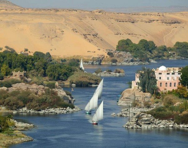
The northern section of the river flows almost entirely through desert, from Sudan into Egypt, a country whose civilization has depended on the river since ancient times. Most of the population and cities of Egypt lie along those parts of the Nile valley north of Aswan, and nearly all the cultural and historical sites of Ancient Egypt are found along riverbanks. The Nile ends in a large delta that empties into the Mediterranean Sea. Above Khartoum the Nile is also known as the White Nile, a term also used in a limited sense to describe the section between Lake No and Khartoum. At Khartoum, the river is joined by the Blue Nile. The White Nile starts in equatorial East Africa, and the Blue Nile begins in Ethiopia. Both branches are on the western flanks of the East African Rift. The drainage basin of the Nile covers 3,254,555 square kilometres (1,256,591 sq mi), about 10% of the area of Africa. The Nile basin is complex, and because of this, the discharge at any given point along the mainstem depends on many factors including weather, diversions, evaporation and evapotranspiration, and groundwater flow.
SOURCE
The source of the Nile is sometimes considered to be Lake Victoria, but the lake has feeder rivers of considerable size. The Kagera River, which flows into Lake Victoria near the Tanzanian town of Bukoba, is the longest feeder, although sources do not agree on which is the longest tributary of the Kagera and hence the most distant source of the Nile itself. It is either the Ruvyironza, which emerges in Bururi Province, Burundi or the Nyabarongo, which flows from Nyungwe Forest in Rwanda. The two feeder rivers meet near Rusumo Falls on the Rwanda-Tanzania border.
NEW SOURCE, NEW WORLD RECORD
Recent exploration says that an exploring party went to a place described as the source of the Rukarara tributary, and by hacking a path up steep jungle-choked mountain slopes in the Nyungwe forest found (in the dry season) an appreciable incoming surface flow for many miles upstream, and found a new source, giving the Nile a length of 4199 miles (6758 kilometres).
Source: Wikipedia

Mount Kilimanjaro (Tanzania)
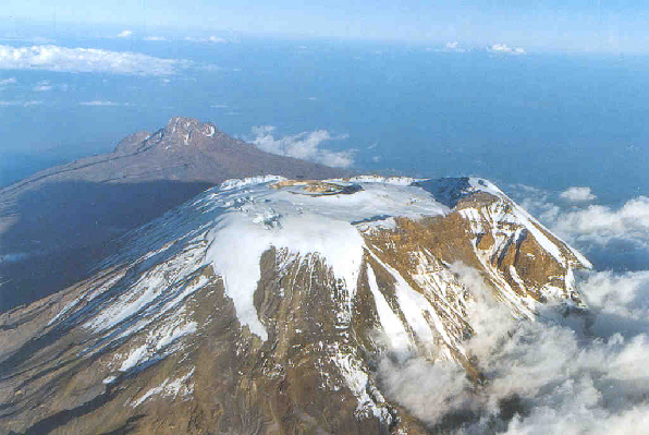
Mount Kilimanjaro, with its three volcanic cones, Kibo, Mawenzi, and Shira, is a dormant volcano in Tanzania and the highest mountain in Africa. Standing at 5,895 metres or 19,341 feet above sea level (the Uhuru Peak/Kibo Peak), snow-capped Kilimanjaro is one of the most famous and highest freestanding mountains in the world, rising from the north-eastern part of Tanzania.
The highest mountain in Africa and the fourth highest of the Seven Summits, Kilimanjaro is situated in the Kilimanjaro National Park in Tanzania. The trek crosses five distinct vegetation zones, namely lower slopes, rainforest, heath and moorland, alpine and desert and the glaciers/summit. Within each zone, there is an association between altitude, rainfall, temperature, plants and animals. The name Kilimanjaro is thought to be a combination of the Swahili word Kilima, meaning “mountain,” and the Kichagga vernacular language word Njaro, translated as “whiteness,” giving the name White Mountain itself.
Kilimanjaro is a giant stratovolcano that began forming a million years ago when lava spilt from the Rift Valley zone. Two of its three peaks, Mawenzi and Shira, are extinct while Kibo (the highest peak) is dormant and could erupt again. The last major eruption has been dated to 360,000 years ago, while the most recent activity was recorded just 200 years ago.
Although it is dormant, Kilimanjaro has fumaroles that emit gas in the crater on the main summit of Kibo. Scientists concluded in 2003 that molten magma is just 400 m (1,310 ft) below the summit crater. Several collapses and landslides have occurred on Kibo in the past, one creating the area known as the Western Breach.

Mosi-oa-Tunya (Victoria) FALLS
The Victoria Falls is the largest waterfall in the world. It is located in southern Africa between the countries of Zambia and Zimbabwe. Called Mosi-oa-Tunya by the locals, which means “the smoke that thunders” until David Livingstone the first European to view the falls, stumbled across it in 1855 and named it Victoria falls in honour of the Queen. Both names are popularly known all over the world.
The Victoria Falls has a width of 1,708 meters (5,604 ft) and a height of 108 meters (354 ft) with an average of 550,000 cubic meters of water plummet over the edge every minute forming the largest sheet of falling water in the world. Its source is from the Zambezi River known to be the fourth longest river in Africa, and the largest flowing into the Indian Ocean from Africa. The fall has two seasons, the wet season which runs from November to April leaving the rest of the month to account for the dry season. The fall’s annual flood is at its peak in the month of April with spray from the falls rising to a height of 400 meters and sometimes twice as high. The minimum flow occurs in November and is around a tenth of the April figure.
Over the years Victoria Falls has been developed to suit the purpose of being a site for tourist attraction. Presently there are two national parks, Mosi-oa-Tunya Park in Zambia and Victoria falls Park in Zimbabwe. Access to the falls can be gained either through the Zambian side which occupies two-thirds of the actual Falls along with the Livingstone Island where David Livingstone first set eyes on the falls or the Zimbabwean side which has the advantage of having the main viewing areas, sightseers and photographers can see approximately 80% of the falls as compared to about 25 to 30% from the Zambian side.
The Falls and the surrounding area are one of the seven natural wonders of the world and have been declared World Heritage Site, thus preserving the area from excessive commercialization.
Similar stories: Kingdoms and Monuments of Africa
